Locate map
The localization (georeferencer) is started automatically after the import, if your 2D data does not have any location information. Your file will be place next to a base map.
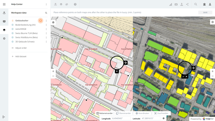
- Select a place on your file that you can easily recognize on the base map. Set a point at the selected location by clicking on the location in your file.
- Mark the selected locaiton on the base map by clicking on the same location on the base map.
- Repeat points one and two at least two more times so that in the end you have marked three points on both maps. The more points you set, the more accurate the placement of your file will be.
- When you are satisfied with the placement, click on Save, your file will now be placed in LUUCY.
The accuracy increases significantly if you zoom in on the maps and place the points very precisely.
Also, the further away the points are from each other, the better. It is best to select 4 points that are at the very edge of your map.
Did you know? The Georeferencer is a tool from MapTiler that allows the user to import images without location information (png, jpg, pdf, tiff) and place them in a location.
Is there anything we could change to make this article helpful?